Building and Roadway Detection (1)
Přehled projektů
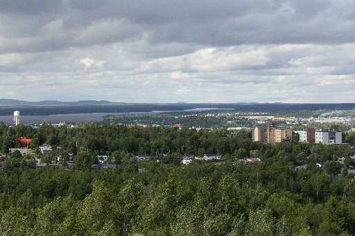
The work of the Canadian Red Cross in our domestic Missing Maps initiative centres around improving the basemap for communities at risk of disaster. In 2023, areas of Val-d'Or were evacuated due to wildfire, a risk increasing year over year. Additionally, this area is heavily reliant on mining and resource extraction, posing potential environmental risks to the surrounding communities. Your contribution to this project will help us identify where buildings and roadways are to better map them for emergency preparedness and response in this region of Québec.
Stáhnout data
Souhrnné výsledky
Souhrnné výsledky (s geometrií)
HOT Tasking Manager Geometrie
Střední až vysoká shoda Ano Možná geometrie
Skupiny
Historie
Výsledky
Úlohy
Uživatelé
Oblast zájmu
Naše licence
Tento projekt je součástí komunity OpenStreetMap. Cílem jsou vysoce kvalitní geografická data, která jsou volně přístupná a dostupná všem. Vzájemná licence OSM chrání data před přivlastněním službami, které je nesdílejí zpět do OSM.
MapSwipe je uvolněn pod "liberální" nereciproční licencí (Creative Commons Attribution). Kdykoli budete chtít data použít, nezapomeňte uvést přispěvatele MapSwipe.