Find - Buildings in West Bay (1)
Přehled projektů
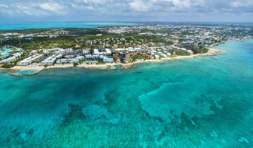
A magnitude-7.6 earthquake recently struck the Cayman Islands, highlighting the region’s vulnerability to seismic activity. While no major damage has been reported, understanding the distribution of buildings is crucial for disaster preparedness and response. Mapping structures in this area helps humanitarian organizations assess potential risks and improve emergency planning. The Cayman Islands sit along a tectonic plate boundary, making accurate and up-to-date data essential for future response efforts. Your contributions to this project will help create valuable information for disaster mitigation and recovery.
Stáhnout data
Oblast zájmu
Naše licence
Tento projekt je součástí komunity OpenStreetMap. Cílem jsou vysoce kvalitní geografická data, která jsou volně přístupná a dostupná všem. Vzájemná licence OSM chrání data před přivlastněním službami, které je nesdílejí zpět do OSM.
MapSwipe je uvolněn pod "liberální" nereciproční licencí (Creative Commons Attribution). Kdykoli budete chtít data použít, nezapomeňte uvést přispěvatele MapSwipe.