Find Features - Find - Buildings in Mapai East - Mozambique (1) HOT
Find Features
Finished
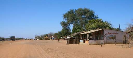
Buildings in Mapai East - Mozambique
HOT
Mar 6, 2025
Project overview
Mozambique ranks among the top ten countries most vulnerable to climate change, facing increasingly frequent and severe disasters that displace thousands of people. For instance, Cyclone Filipo in March 2024 displaced 48,000 individuals. The World Bank warns that without proactive adaptation measures, an additional 1.6 million people could fall into poverty by 2050. The country’s vulnerability is driven by its extensive coastline and nine major river basins, making it highly susceptible to climate-related disasters. In this challenging context, anticipatory action is crucial to safeguarding both populations and economic assets. Disaster management efforts in Mozambique are led by the Instituto Nacional de Gestão e Redução do Risco de Desastres (INGD), which operates through regional offices and community-based disaster risk reduction committees. These efforts focus on preparedness, early warning systems, and coordinated response initiatives.
\n\n \n\n
To enhance disaster resilience, the Humanitarian OpenStreetMap Team (HOT), the Fundação para o Desenvolvimento da Comunidade (FDC), INGD, and INGD's National Center for Emergency Operations (CENOE) have joined forces on the "Mapping Populations and Services in Rural Mozambique" project. This initiative aims to revolutionize disaster preparedness by integrating modern technology with the invaluable local knowledge of the communities most affected by climate change. Through participatory mapping, the project actively involves communities in data collection and risk assessment, empowering them to play a pivotal role in shaping disaster response strategies. By recognizing the importance of local insights and ensuring community engagement, the project strengthens resilience and enhances the effectiveness of disaster preparedness efforts in Mozambique.
3121
km2
426
Contributors
Project Completion
100% completed
Last updated: Oct 13, 2025
Download the data
Below you'll find the data downloads for this MapSwipe project, including a GeoJSON file that can be imported into the HOT Tasking Manager for more detailed mapping of the area. If you need more information or if you have a special request related to MapSwipe data get in contact with the team at the Heidelberg Institute for Geoinformation Technology
Aggregated Results
Aggregated Results. This gives you the unfiltered MapSwipe results aggregated on the task level. This is most suited if you want to apply some custom data processing with the MapSwipe data, e.g. select only specific tasks. Check our documentation for more details. (Note that you need to unzip this .gz file before you can use it.)
GZIP
4.8 MB
Aggregated Results (with Geometry)
Aggregated Results. This gives you the unfiltered MapSwipe results aggregated on the task level. This is most suited if you want to apply some custom data processing with the MapSwipe data, e.g. select only specific tasks. Check our documentation for more details. (Note that you need to unzip this .gz file before you can use it.)
GZIP
4.7 MB
Groups
Groups. (Note that you need to unzip this .gz file before you can use it.)
GZIP
9.1 kB
History
History
CSV
0.7 kB
Results
This gives you the unfiltered MapSwipe results. (Note that you need to unzip this .gz file before you can use it.)
GZIP
3 MB
Tasks
Tasks. (Note that you need to unzip this .gz file before you can use it.)
GZIP
4.3 MB
Users
This dataset contains information on the individual contributions per user. This tells you for instance the most active users of this project. (Note that you need to unzip this .gz file before you can use it.)
GZIP
20.6 kB
Area of Interest
This dataset contains information on the project region.
GEOJSON
0.7 kB
HOT Tasking Manager Geometries
This dataset contains shapes that are ready to use in the HOT Tasking Manager. Currently, the geometries consist of maximum 15 MapSwipe Tasks, where at least 35% of all users indicated the presence of a building by classifying as "yes" or "maybe"
GEOJSON
0.1 MB
Moderate to High Agreement Yes Maybe Geometries
This dataset contains all results where at least 35% of users submitted a "yes" or "maybe" classification. The output dataset depicts the union of all selected results.
GEOJSON
0.3 MB
Our license
This project is part of the OpenStreetMap community. The goal is high-quality geographical data, freely accessible and available to everyone. OSM’s reciprocal license protects the data from being appropriated by services that do not share back to OSM.
MapSwipe is released under a "liberal" non-reciprocal license (Creative Commons Attribution). Whenever you want to use the data, just make sure to credit the MapSwipe contributors.
