Find Buildings - Flood Response AAli Abad (3)
Přehled projektů
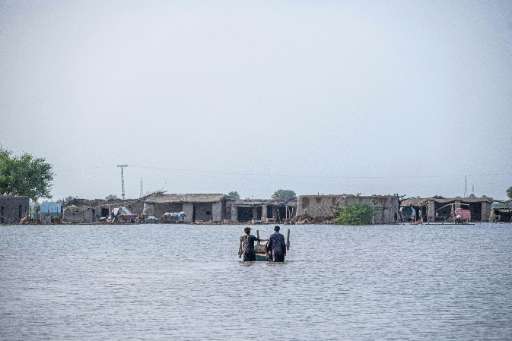
This MapSwipe project aims to identify building footprints in areas affected by the recent flooding in Pakistan (August 2025). By using this tool, mappers will help identify buildings to understand the extent of affected areas, which will turn in help in the response and recovery efforts. The resulting data is crucial for understanding the scope of the disaster and effectively directing aid to those in need. Thanks for your collaboration!
Stáhnout data
Souhrnné výsledky
Souhrnné výsledky (s geometrií)
HOT Tasking Manager Geometrie
Střední až vysoká shoda Ano Možná geometrie
Skupiny
Historie
Výsledky
Úlohy
Uživatelé
Oblast zájmu
Naše licence
Tento projekt je součástí komunity OpenStreetMap. Cílem jsou vysoce kvalitní geografická data, která jsou volně přístupná a dostupná všem. Vzájemná licence OSM chrání data před přivlastněním službami, které je nesdílejí zpět do OSM.
MapSwipe je uvolněn pod "liberální" nereciproční licencí (Creative Commons Attribution). Kdykoli budete chtít data použít, nezapomeňte uvést přispěvatele MapSwipe.