Check Completeness - Water Sources Completeness Baidoa Burhakaba - Somalia (4) HOT
Check Completeness
Active
Somalia
HOT
Mar 21, 2026
Project overview
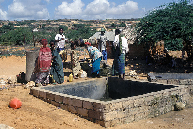
Water is life. It is a basic human necessity, yet millions of people—particularly in Africa rural areas —still lack reliable access to clean and safe water. While water scarcity affects entire communities, women and girls carry a disproportionate share of the burden.
In many communities, women and girls are primarily responsible for collecting water, often walking long distances each day. This reality affects nearly every aspect of their lives, limiting access to education, impacting health, reducing economic opportunities, and increasing exposure to safety risks.
This project focuses on the identification of water sources to update the data needed for more effective water planning. In the context of World Water Day, this initiative demonstrates how digital mapping can reduce vulnerability, empower women, and support sustainable water access—helping ensure that communities are not only visible on the map, but better served in the long term.
The scope is to identyfy updates and check completeness of water sources in Somalia to mantain updated the info from previous campaigns. More info [here](https://www.hotosm.org/en/projects/mapping-surface-water-sources-in-somalia/)
4506
km2
0
Contributors
Project Completion
0% completed
Download the data
Below you'll find the data downloads for this MapSwipe project, including a GeoJSON file that can be imported into the HOT Tasking Manager for more detailed mapping of the area. If you need more information or if you have a special request related to MapSwipe data get in contact with the team at the Heidelberg Institute for Geoinformation Technology
Area of Interest
This dataset contains information on the project region.
GEOJSON
0.7 kB
Our license
This project is part of the OpenStreetMap community. The goal is high-quality geographical data, freely accessible and available to everyone. OSM’s reciprocal license protects the data from being appropriated by services that do not share back to OSM.
MapSwipe is released under a "liberal" non-reciprocal license (Creative Commons Attribution). Whenever you want to use the data, just make sure to credit the MapSwipe contributors.
