Validate Footprints - Health facilities - Uganda (4) MSF
Validate Footprints
Active
Uganda
MSF
Jun 8, 2026
Project overview
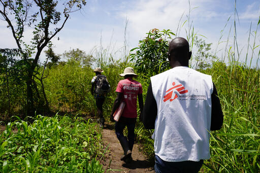
On 15 May 2026, the Democratic Republic of Congo's Ministry of Health officially declared an Ebola disease outbreak in the northeast of the country, where Médecins Sans Frontières (MSF) teams are operating. On the same day, Uganda announced the virus had crossed the border. Help us validate locations of health facilities to ensure our teams have up to date data.
**This is important project, please take your time.**
160
km2
94
Contributors
Project Completion
83% completed
Last updated: Jun 12, 2026
Download the data
Below you'll find the data downloads for this MapSwipe project, including a GeoJSON file that can be imported into the HOT Tasking Manager for more detailed mapping of the area. If you need more information or if you have a special request related to MapSwipe data get in contact with the team at the Heidelberg Institute for Geoinformation Technology
Aggregated Results
Aggregated Results. This gives you the unfiltered MapSwipe results aggregated on the task level. This is most suited if you want to apply some custom data processing with the MapSwipe data, e.g. select only specific tasks. Check our documentation for more details. (Note that you need to unzip this .gz file before you can use it.)
GZIP
0.9 MB
Aggregated Results (with Geometry)
Aggregated Results. This gives you the unfiltered MapSwipe results aggregated on the task level. This is most suited if you want to apply some custom data processing with the MapSwipe data, e.g. select only specific tasks. Check our documentation for more details. (Note that you need to unzip this .gz file before you can use it.)
GZIP
0.9 MB
Groups
Groups. (Note that you need to unzip this .gz file before you can use it.)
GZIP
3.5 kB
History
History
CSV
0.6 kB
Results
This gives you the unfiltered MapSwipe results. (Note that you need to unzip this .gz file before you can use it.)
GZIP
0.2 MB
Tasks
Tasks. (Note that you need to unzip this .gz file before you can use it.)
GZIP
0.9 MB
Users
This dataset contains information on the individual contributions per user. This tells you for instance the most active users of this project. (Note that you need to unzip this .gz file before you can use it.)
GZIP
4.3 kB
Area of Interest
This dataset contains information on the project region.
GEOJSON
0.6 kB
Our license
This project is part of the OpenStreetMap community. The goal is high-quality geographical data, freely accessible and available to everyone. OSM’s reciprocal license protects the data from being appropriated by services that do not share back to OSM.
MapSwipe is released under a "liberal" non-reciprocal license (Creative Commons Attribution). Whenever you want to use the data, just make sure to credit the MapSwipe contributors.
