Building and Roadway Detection (1)

Projekt áttekintése
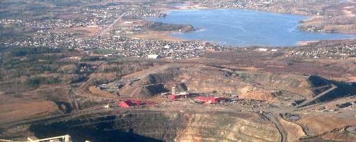
The work of the Canadian Red Cross in our domestic Missing Maps initiative centres around improving the basemap for communities at risk of disaster. Timmins, located on the traditional territory of the Mattagami First Nation in what is now Northeastern Ontario, is an area historically reliant on gold mining and resource extraction, posing potential environmental risks to the surrounding communities. Wildfires also pose potential risks to this area due to the surrounding dense forest, and seasonal flooding from the Mattagami River is also a concern. Your contribution to this project will help us identify where buildings and roadways are to better map them for emergency preparedness and response in this rural region of Ontario.
Adatok letöltése
Összesített eredmények
Összesített eredmnyek (alakzatokkal)
HOT Tasking Manager feladatkezelő alakzatok
Moderálás „nagy egyetértés”, „igen” és „talán” alakzatokra
Csoportok
Előzmények
Eredmények
Feladatok
Felhasználók
Érintett terület
Licenc
Ez a projekt az OpenStreetMap közösség része. A cél a kiváló minőségű, szabadon hozzáférhető és mindenki számára elérhető földrajzi adatok létrehozása. Az adatokat az OSM kölcsönös licenc védi attól, hogy olyan olyan szolgáltatások sajátítsák ki őket, amelyek nem osztják őket vissza az OSM felé.
A MapSwipe „liberális”, nem kölcsönös licenc (Creative Commons Attribution) alatt van kiadva. Ha szeretné felhasználni az adatokat, csupán arra figyeljen, hogy tüntesse fel a MapSwipe közreműködőit.
