Validate Footprints - Validate - Buildings in Yoro East - Honduras (1) HOT
Validate Footprints
Finished
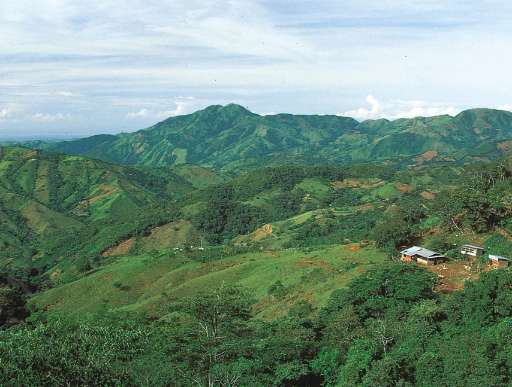
Buildings in Yoro East - Honduras
HOT
Sep 25, 2024
Project overview
This is a validate project type. You are looking to validate building footprints. Please use the tutorial to contribute.
*Project Description*
Area of Yoro East, Honduras were mapped in 2022 to support disaster risk reduction programming. Help us understand the quality of the OSM building data in the area. The results will be used to help evaluate if the area should be re-mapped.
129
km2
67
Contributors
Project Completion
100% completed
Last updated: Oct 13, 2025
Download the data
Below you'll find the data downloads for this MapSwipe project, including a GeoJSON file that can be imported into the HOT Tasking Manager for more detailed mapping of the area. If you need more information or if you have a special request related to MapSwipe data get in contact with the team at the Heidelberg Institute for Geoinformation Technology
Aggregated Results
Aggregated Results. This gives you the unfiltered MapSwipe results aggregated on the task level. This is most suited if you want to apply some custom data processing with the MapSwipe data, e.g. select only specific tasks. Check our documentation for more details. (Note that you need to unzip this .gz file before you can use it.)
GZIP
41.6 kB
Aggregated Results (with Geometry)
Aggregated Results. This gives you the unfiltered MapSwipe results aggregated on the task level. This is most suited if you want to apply some custom data processing with the MapSwipe data, e.g. select only specific tasks. Check our documentation for more details. (Note that you need to unzip this .gz file before you can use it.)
GZIP
45.2 kB
Groups
Groups. (Note that you need to unzip this .gz file before you can use it.)
GZIP
0.3 kB
History
History
CSV
0.3 kB
Results
This gives you the unfiltered MapSwipe results. (Note that you need to unzip this .gz file before you can use it.)
GZIP
33.9 kB
Tasks
Tasks. (Note that you need to unzip this .gz file before you can use it.)
GZIP
40.2 kB
Users
This dataset contains information on the individual contributions per user. This tells you for instance the most active users of this project. (Note that you need to unzip this .gz file before you can use it.)
GZIP
3 kB
Area of Interest
This dataset contains information on the project region.
GEOJSON
0.6 kB
Our license
This project is part of the OpenStreetMap community. The goal is high-quality geographical data, freely accessible and available to everyone. OSM’s reciprocal license protects the data from being appropriated by services that do not share back to OSM.
MapSwipe is released under a "liberal" non-reciprocal license (Creative Commons Attribution). Whenever you want to use the data, just make sure to credit the MapSwipe contributors.
