Check Completeness - Water Sources Completeness - Somalia (63) HOT
Check Completeness
Active
Somalia
HOT
Mar 12, 2026
Project overview
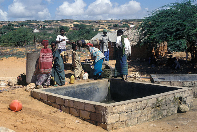
Water is life. It is a basic human necessity, yet millions of people—particularly in Africa rural areas —still lack reliable access to clean and safe water. While water scarcity affects entire communities, women and girls carry a disproportionate share of the burden.
In many communities, women and girls are primarily responsible for collecting water, often walking long distances each day. This reality affects nearly every aspect of their lives, limiting access to education, impacting health, reducing economic opportunities, and increasing exposure to safety risks.
This project focuses on the identification of water sources to update the data needed for more effective water planning. In the context of World Water Day, this initiative demonstrates how digital mapping can reduce vulnerability, empower women, and support sustainable water access—helping ensure that communities are not only visible on the map, but better served in the long term.
The scope is to identyfy updates and check completeness of water sources in Somalia to mantain updated the info from previous campaigns. More info [here](https://www.hotosm.org/en/projects/mapping-surface-water-sources-in-somalia/)
1998
km2
8
Contributors
Project Completion
1% completed
Last updated: Mar 20, 2026
Download the data
Below you'll find the data downloads for this MapSwipe project, including a GeoJSON file that can be imported into the HOT Tasking Manager for more detailed mapping of the area. If you need more information or if you have a special request related to MapSwipe data get in contact with the team at the Heidelberg Institute for Geoinformation Technology
Aggregated Results
Aggregated Results. This gives you the unfiltered MapSwipe results aggregated on the task level. This is most suited if you want to apply some custom data processing with the MapSwipe data, e.g. select only specific tasks. Check our documentation for more details. (Note that you need to unzip this .gz file before you can use it.)
GZIP
0.3 MB
Aggregated Results (with Geometry)
Aggregated Results. This gives you the unfiltered MapSwipe results aggregated on the task level. This is most suited if you want to apply some custom data processing with the MapSwipe data, e.g. select only specific tasks. Check our documentation for more details. (Note that you need to unzip this .gz file before you can use it.)
GZIP
0.3 MB
Groups
Groups. (Note that you need to unzip this .gz file before you can use it.)
GZIP
9.6 kB
History
History
CSV
0.5 kB
Results
This gives you the unfiltered MapSwipe results. (Note that you need to unzip this .gz file before you can use it.)
GZIP
76 kB
Tasks
Tasks. (Note that you need to unzip this .gz file before you can use it.)
GZIP
2.4 MB
Users
This dataset contains information on the individual contributions per user. This tells you for instance the most active users of this project. (Note that you need to unzip this .gz file before you can use it.)
GZIP
0.5 kB
Area of Interest
This dataset contains information on the project region.
GEOJSON
0.7 kB
HOT Tasking Manager Geometries
This dataset contains shapes that are ready to use in the HOT Tasking Manager. Currently, the geometries consist of maximum 15 MapSwipe Tasks, where at least 35% of all users indicated the presence of a building by classifying as "yes" or "maybe"
GEOJSON
18 kB
Moderate to High Agreement Yes Maybe Geometries
This dataset contains all results where at least 35% of users submitted a "yes" or "maybe" classification. The output dataset depicts the union of all selected results.
GEOJSON
32.6 kB
Our license
This project is part of the OpenStreetMap community. The goal is high-quality geographical data, freely accessible and available to everyone. OSM’s reciprocal license protects the data from being appropriated by services that do not share back to OSM.
MapSwipe is released under a "liberal" non-reciprocal license (Creative Commons Attribution). Whenever you want to use the data, just make sure to credit the MapSwipe contributors.
