Building and Roadway Detection (1)

Visão geral do projeto
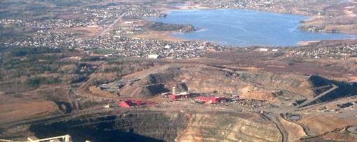
The work of the Canadian Red Cross in our domestic Missing Maps initiative centres around improving the basemap for communities at risk of disaster. Timmins, located on the traditional territory of the Mattagami First Nation in what is now Northeastern Ontario, is an area historically reliant on gold mining and resource extraction, posing potential environmental risks to the surrounding communities. Wildfires also pose potential risks to this area due to the surrounding dense forest, and seasonal flooding from the Mattagami River is also a concern. Your contribution to this project will help us identify where buildings and roadways are to better map them for emergency preparedness and response in this rural region of Ontario.
Descarregar os dados
Resultados agregados
Resultados agregados (com geometria)
Geometrias HOT Tasking Manager
Moderado a Elevado Acordo Sim Talvez Geometrias
Grupos
História
Resultados
Tarefas
Utilizadores
Área de interesse
A nossa licença
Este projeto faz parte da comunidade OpenStreetMap. O objetivo é obter dados geográficos de alta qualidade, de acesso livre e disponíveis para todos. A licença recíproca do OSM protege os dados de serem apropriados por serviços que não partilham com o OSM.
O MapSwipe é disponibilizado ao abrigo de uma licença "liberal" não recíproca (Creative Commons Atribuição). Sempre que quiser utilizar os dados, certifique-se de que atribui os créditos aos contribuidores do MapSwipe.
