Find - Buildings in Mapai East (1)
Visão geral do projeto
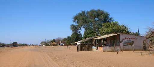
Mozambique ranks among the top ten countries most vulnerable to climate change, facing increasingly frequent and severe disasters that displace thousands of people. For instance, Cyclone Filipo in March 2024 displaced 48,000 individuals. The World Bank warns that without proactive adaptation measures, an additional 1.6 million people could fall into poverty by 2050. The country’s vulnerability is driven by its extensive coastline and nine major river basins, making it highly susceptible to climate-related disasters. In this challenging context, anticipatory action is crucial to safeguarding both populations and economic assets. Disaster management efforts in Mozambique are led by the Instituto Nacional de Gestão e Redução do Risco de Desastres (INGD), which operates through regional offices and community-based disaster risk reduction committees. These efforts focus on preparedness, early warning systems, and coordinated response initiatives.
To enhance disaster resilience, the Humanitarian OpenStreetMap Team (HOT), the Fundação para o Desenvolvimento da Comunidade (FDC), INGD, and INGD's National Center for Emergency Operations (CENOE) have joined forces on the "Mapping Populations and Services in Rural Mozambique" project. This initiative aims to revolutionize disaster preparedness by integrating modern technology with the invaluable local knowledge of the communities most affected by climate change. Through participatory mapping, the project actively involves communities in data collection and risk assessment, empowering them to play a pivotal role in shaping disaster response strategies. By recognizing the importance of local insights and ensuring community engagement, the project strengthens resilience and enhances the effectiveness of disaster preparedness efforts in Mozambique.
Descarregar os dados
Resultados agregados
Resultados agregados (com geometria)
Geometrias HOT Tasking Manager
Moderado a Elevado Acordo Sim Talvez Geometrias
Grupos
História
Resultados
Tarefas
Utilizadores
Área de interesse
A nossa licença
Este projeto faz parte da comunidade OpenStreetMap. O objetivo é obter dados geográficos de alta qualidade, de acesso livre e disponíveis para todos. A licença recíproca do OSM protege os dados de serem apropriados por serviços que não partilham com o OSM.
O MapSwipe é disponibilizado ao abrigo de uma licença "liberal" não recíproca (Creative Commons Atribuição). Sempre que quiser utilizar os dados, certifique-se de que atribui os créditos aos contribuidores do MapSwipe.