Check Completeness - BC Fraser Valley Flood Preparedness - British Columbia, Canada (1) Canadian Red Cross
Check Completeness
Finished
British Columbia, Canada
Canadian Red Cross
Jun 12, 2026
Project overview
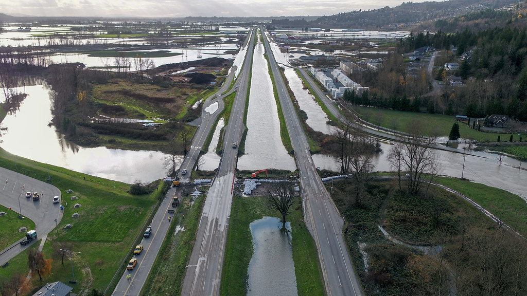
This MapSwipe project supports flood preparedness in British Columbia’s Fraser Valley by identifying areas where buildings may be missing from OpenStreetMap.
Volunteers are asked to review each image tile and check whether all visible buildings are already mapped. This helps improve baseline exposure data for flood risk analysis, emergency planning, and community preparedness.
210
km2
0
Contributors
Project Completion
0% completed
Download the data
Below you'll find the data downloads for this MapSwipe project, including a GeoJSON file that can be imported into the HOT Tasking Manager for more detailed mapping of the area. If you need more information or if you have a special request related to MapSwipe data get in contact with the team at the Heidelberg Institute for Geoinformation Technology
Area of Interest
This dataset contains information on the project region.
GEOJSON
0.7 kB
Our license
This project is part of the OpenStreetMap community. The goal is high-quality geographical data, freely accessible and available to everyone. OSM’s reciprocal license protects the data from being appropriated by services that do not share back to OSM.
MapSwipe is released under a "liberal" non-reciprocal license (Creative Commons Attribution). Whenever you want to use the data, just make sure to credit the MapSwipe contributors.
