Deforestation in Central America and Mexico (2)

Compare
Finished
Mexico Chunhuhub
Co.Mapper
Aug 5, 2022
Deforestation in Central America and Mexico (2)

Project overview

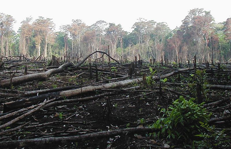
This project aims to detect forest loss in Central America and Mexico. You will be comparing an older set of Bing satellite imagery against newer Maxar imagery to look for evidence of forest loss. This will help generating a detailed map of the extent and severity of forest loss in recent years. It is important to gather this information because there is a strong relationship between forest loss and negative environmental impacts and climate change. It should also enable us to identify the causes of forest loss, which will assist in any collaborations with local organisations to plan actions. This is part of the wider OpenCities program, which aims to shed light on the relationship between local communities and nearby forests. Este proyecto tiene como objetivo detectar la pérdida de bosques en América Central y México. Compararás un conjunto de imágenes satelitales de Bing más antiguas, con imágenes Maxar más recientes, para buscar evidencia de la pérdida de bosques. Esto permitirá generar un mapa detallado de la extensión y gravedad de la pérdida de bosques en los últimos años. Es importante reunir esta información porque existe una fuerte relación entre la pérdida de bosques y los impactos ambientales negativos y el cambio climático. También debería permitirnos identificar las causas de la pérdida de bosques, lo que ayudará en cualquier colaboración con organizaciones locales para plantear acciones. Esto forma parte del programa más amplio OpenCities, que pretende arrojar luz sobre la relación entre las comunidades locales y los bosques cercanos.

3853
km2
1315
Contributors
Project Completion
100% completed
020406080100Aug 05, 22Aug 18, 22Sep 01, 22Sep 15, 22Sep 29, 22Oct 13, 22
Last updated: Jul 26, 2024, 12:10:20 AM

Download the data

Below you'll find the data downloads for this MapSwipe project, including a GeoJSON file that can be imported into the HOT Tasking Manager for more detailed mapping of the area. If you need more information or if you have a special request related to MapSwipe data get in contact with the team at the Heidelberg Institute for Geoinformation Technology
Aggregated Results
Aggregated Results. This gives you the unfiltered MapSwipe results aggregated on the task level. This is most suited if you want to apply some custom data processing with the MapSwipe data, e.g. select only specific tasks. Check our documentation for more details. (Note that you need to unzip this .gz file before you can use it.)
csv
6.3 MB
Download
Aggregated Results (with Geometry)
Aggregated Results. This gives you the unfiltered MapSwipe results aggregated on the task level. This is most suited if you want to apply some custom data processing with the MapSwipe data, e.g. select only specific tasks. Check our documentation for more details. (Note that you need to unzip this .gz file before you can use it.)
geojson
6.3 MB
Download
HOT Tasking Manager Geometries
This dataset contains shapes that are ready to use in the HOT Tasking Manager. Currently, the geometries consist of maximum 15 MapSwipe Tasks, where at least 35% of all users indicated the presence of a building by classifying as "yes" or "maybe"
geojson
0.6 MB
Download
Moderate to High Agreement Yes Maybe Geometries
This dataset contains all results where at least 35% of users submitted a "yes" or "maybe" classification. The output dataset depicts the union of all selected results.
geojson
1.1 MB
Download
Groups
Groups. (Note that you need to unzip this .gz file before you can use it.)
csv
21 kB
Download
History
History
geojson
7.1 kB
Download
Results
This gives you the unfiltered MapSwipe results. (Note that you need to unzip this .gz file before you can use it.)
csv
4.3 MB
Download
Tasks
Tasks. (Note that you need to unzip this .gz file before you can use it.)
csv
5.5 MB
Download
Users
This dataset contains information on the individual contributions per user. This tells you for instance the most active users of this project. (Note that you need to unzip this .gz file before you can use it.)
csv
47.7 kB
Download
Area of Interest
This dataset contains information on the project region.
geojson
0.5 kB
Download

Our license

This project is part of the OpenStreetMap community. The goal is high-quality geographical data, freely accessible and available to everyone. OSM’s reciprocal license protects the data from being appropriated by services that do not share back to OSM.

MapSwipe is released under a "liberal" non-reciprocal license (Creative Commons Attribution). Whenever you want to use the data, just make sure to credit the MapSwipe contributors.