Find Features - Dissarter prevention - Tena Ecuador (2) OpenMappingHub - LAC
Find Features
Finished
Tena Ecuador
OpenMappingHub - LAC
Sep 21, 2023
Project overview
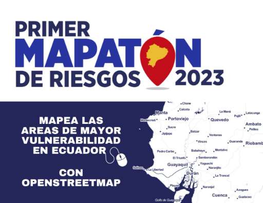
Iniciativa encabezada por la Secretaría de Gestión de Riesgos del Ecuador, en colaboración con actores estratégicos de la sociedad civil, academia, comunidad, gobiernos locales, ONGs, cooperación internacional, sector público y privado. Su objetivo es contribuir al cierre de brechas de información a través del mapeo participativo y colaborativo en relación a los factores de riesgo en 5 ciudades: Quito, Guayaquil, Loja, Tena y Latacunga. Esto, a través de la aplicación de plataformas y sistemas de información geográfica, prácticas ciudadanas e innovación.
1264
km2
208
Contributors
Project Completion
100% completed
Last updated: Oct 13, 2025
Download the data
Below you'll find the data downloads for this MapSwipe project, including a GeoJSON file that can be imported into the HOT Tasking Manager for more detailed mapping of the area. If you need more information or if you have a special request related to MapSwipe data get in contact with the team at the Heidelberg Institute for Geoinformation Technology
Aggregated Results
Aggregated Results. This gives you the unfiltered MapSwipe results aggregated on the task level. This is most suited if you want to apply some custom data processing with the MapSwipe data, e.g. select only specific tasks. Check our documentation for more details. (Note that you need to unzip this .gz file before you can use it.)
GZIP
1.8 MB
Aggregated Results (with Geometry)
Aggregated Results. This gives you the unfiltered MapSwipe results aggregated on the task level. This is most suited if you want to apply some custom data processing with the MapSwipe data, e.g. select only specific tasks. Check our documentation for more details. (Note that you need to unzip this .gz file before you can use it.)
GZIP
1.9 MB
Groups
Groups. (Note that you need to unzip this .gz file before you can use it.)
GZIP
4.1 kB
History
History
CSV
1.8 kB
Results
This gives you the unfiltered MapSwipe results. (Note that you need to unzip this .gz file before you can use it.)
GZIP
1 MB
Tasks
Tasks. (Note that you need to unzip this .gz file before you can use it.)
GZIP
1.4 MB
Users
This dataset contains information on the individual contributions per user. This tells you for instance the most active users of this project. (Note that you need to unzip this .gz file before you can use it.)
GZIP
10.1 kB
Area of Interest
This dataset contains information on the project region.
GEOJSON
0.2 MB
HOT Tasking Manager Geometries
This dataset contains shapes that are ready to use in the HOT Tasking Manager. Currently, the geometries consist of maximum 15 MapSwipe Tasks, where at least 35% of all users indicated the presence of a building by classifying as "yes" or "maybe"
GEOJSON
0.1 MB
Moderate to High Agreement Yes Maybe Geometries
This dataset contains all results where at least 35% of users submitted a "yes" or "maybe" classification. The output dataset depicts the union of all selected results.
GEOJSON
0.2 MB
Our license
This project is part of the OpenStreetMap community. The goal is high-quality geographical data, freely accessible and available to everyone. OSM’s reciprocal license protects the data from being appropriated by services that do not share back to OSM.
MapSwipe is released under a "liberal" non-reciprocal license (Creative Commons Attribution). Whenever you want to use the data, just make sure to credit the MapSwipe contributors.
