Identificación de coberturas - Michoacán (2)
Project overview
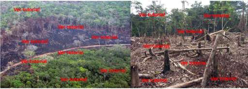
Para contribuir con este proyecto primero ver tutorial Este proyecto busca identificar los cambios que ocurren en los ecosistemas naturales del estado de Michoacán en México. Ayúdanos a detectar las áreas donde vegetación natural ha desaparecido, por medio de la observación de imágenes de satélite. Tu participación contribuye a la construcción de mapas que tienen la finalidad de plantear acciones de restauración, conservación y manejo sustentable de ecosistemas.
Download the data
Area of Interest
Our license
This project is part of the OpenStreetMap community. The goal is high-quality geographical data, freely accessible and available to everyone. OSM’s reciprocal license protects the data from being appropriated by services that do not share back to OSM.
MapSwipe is released under a "liberal" non-reciprocal license (Creative Commons Attribution). Whenever you want to use the data, just make sure to credit the MapSwipe contributors.