Find Buildings - Flood Response Chilas (3)
Project overview
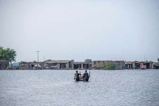
This MapSwipe project aims to identify building footprints in areas affected by the recent flooding in Pakistan (August 2025). By collaborating on this project, mappers will help to identify buildings to understand the extent of affected areas, which will turn in helping in the response and recovery efforts. The resulting data is crucial for understanding the scope of the disaster and effectively directing aid to those in need. Photo by Kafeel Ahmed.
Download the data
Aggregated Results
Aggregated Results (with Geometry)
HOT Tasking Manager Geometries
Moderate to High Agreement Yes Maybe Geometries
Groups
History
Results
Tasks
Users
Area of Interest
Our license
This project is part of the OpenStreetMap community. The goal is high-quality geographical data, freely accessible and available to everyone. OSM’s reciprocal license protects the data from being appropriated by services that do not share back to OSM.
MapSwipe is released under a "liberal" non-reciprocal license (Creative Commons Attribution). Whenever you want to use the data, just make sure to credit the MapSwipe contributors.