Validate Footprints - OSM Building Validation - Corozal, Belize (2) American Red Cross
Validate Footprints
Finished
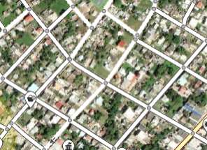
Corozal, Belize
American Red Cross
Sep 5, 2022
Project overview
This is an OSM building validation project type. You are looking to validate building footprints. Please use the tutorial to learn how to contribute. \n\n **Project description** \n\n Areas of Corozal, Belize were mapped in 2016 to support disaster risk reduction programming. Help us understand the quality of the OSM building data in the area. The results will be used to help evaluate if the area should be re-mapped.
41
km2
0
Contributors
Project Completion
0% completed
Download the data
Below you'll find the data downloads for this MapSwipe project, including a GeoJSON file that can be imported into the HOT Tasking Manager for more detailed mapping of the area. If you need more information or if you have a special request related to MapSwipe data get in contact with the team at the Heidelberg Institute for Geoinformation Technology
Area of Interest
This dataset contains information on the project region.
GEOJSON
0.6 kB
Our license
This project is part of the OpenStreetMap community. The goal is high-quality geographical data, freely accessible and available to everyone. OSM’s reciprocal license protects the data from being appropriated by services that do not share back to OSM.
MapSwipe is released under a "liberal" non-reciprocal license (Creative Commons Attribution). Whenever you want to use the data, just make sure to credit the MapSwipe contributors.
