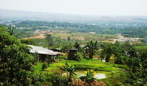
Finding buildings in Puerto Garzón, Caquetá (1)
Projektübersicht
Please look for buildings. You can view the tutorial to learn how to best contribute. Thank you! Mapping in areas of high multidimensional poverty is of crucial relevance, as women play an essential role in indigenous populations, and contribute significantly to social cohesion, cultural preservation and community sustainability. In addition, women in indigenous communities are transmitters of local knowledge and assume fundamental responsibilities in the management of natural resources and environmental preservation. Women's active participation in their communities strengthens resilience in the face of socioeconomic and environmental challenges. In the context of the Amazon, mapping becomes critically important when considering vulnerability and the need to preserve valuable natural resources. When women in these communities have detailed information of their surroundings, it facilitates strategic planning against threats, and contributes to the implementation of adaptation and protection measures, to ensure the long-term survival of the region and its population. In the context of the Amazon, mapping becomes critically important when considering vulnerability and the need to preserve valuable natural resources. When women in these communities have detailed information of their surroundings, it facilitates strategic planning against threats, and contributes to the implementation of adaptation and protection measures, to ensure the long-term survival of the region and its population.
Daten herunterladen
Interessenbereich
Unsere Lizenz
Dieses Projekt ist Teil der OpenStreetMap Gemeinschaft. Das Ziel ist es Geographische Daten auf Qualitativ hohem Niveau frei zugänglich und für jedermann verfügbar zu machen. Die gegenseitige Lizenz von OSM schützt die Daten vor der Aneignung durch Dienste, die sie nicht an OSM zurückgeben.
MapSwipe wird unter einer „liberalen“ non-reciprocal license (Creative Commons Attribution) veröffentlicht. Wann immer du die Daten verwenden möchten, stelle sicher, dass du die MapSwipe-Mitwirkenden erwähnst.