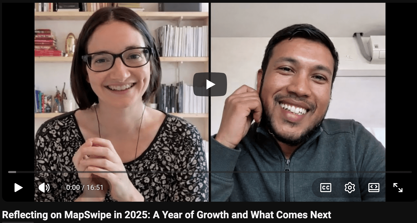
Reflecting on MapSwipe in 2025: A Year of Growth and What Comes Next
2025 was a big year for MapSwipe.
With major technical upgrades behind the scenes, brand new project types, and stronger community collaboration, the MapSwipe ecosystem took meaningful steps this past year towards becoming more flexible, sustainable, and future-ready.
In this conversation, Nicole and Amar, from the MapSwipe governance team, reflect on the past year: celebrating what shipped, unpacking why certain decisions mattered, and looking ahead to what’s coming in 2026. Together, they talk through the backend revamp, new ways of working for technical contributors, and how emerging project types are expanding what’s possible with MapSwipe.
Whether you’re deeply involved in MapSwipe or just curious about the past year and where the project is headed, this conversation offers a clear snapshot of how the project is evolving.
Nicole
Hey Amar. Nice to see you today. I'm really glad that we have the time to talk about MapSwipe in 2025 and all the cool things that happened this year and get to celebrate a little bit.
Amar
Yeah, absolutely. I'm excited as well. So, yeah, let's get this started.
Nicole
Let's get it started. So, the first thing I would love to ask you about is the backend revamp because some really cool things happened this year that are going to make things a lot easier for a lot of project managers. So, can you tell me a little bit about it?
Amar
Absolutely. Yeah. One of the reasons the backend revamp happened was for the project managers to be able to create projects more easily. So, we made a lot of changes. We revamped the backend. Previously, the project managers did not have a lot of flexibility when creating projects, but now they can do a lot of stuff, including editing the text of the projects. The project creation steps are a little bit easier. We have also increased and improved the developer experience as well.
Overall, the focus of the backend revamp was to make sure that the project manager experience is enhanced. And it also has created the foundation in such a way that it is now more stable and we can now add a lot of other project types. It also has allowed us to communicate with the users in a better way. For example, users can now receive error messages. We also have integrated the Slack notification system, which has helped notify users whenever there is a project created, or whenever a project is completed. And overall, it has been a great journey. We have also worked a little bit on creating documentation and have now documented a lot of the steps that the project managers need to follow. So overall it’s been good for both the project managers and for the MapSwipe ecosystem.
“The focus of the backend revamp was to make sure that the project manager experience is enhanced.”
Nicole
That's amazing. I feel like that's going to be really helpful for the community, for sure.
Amar
Absolutely.
Nicole
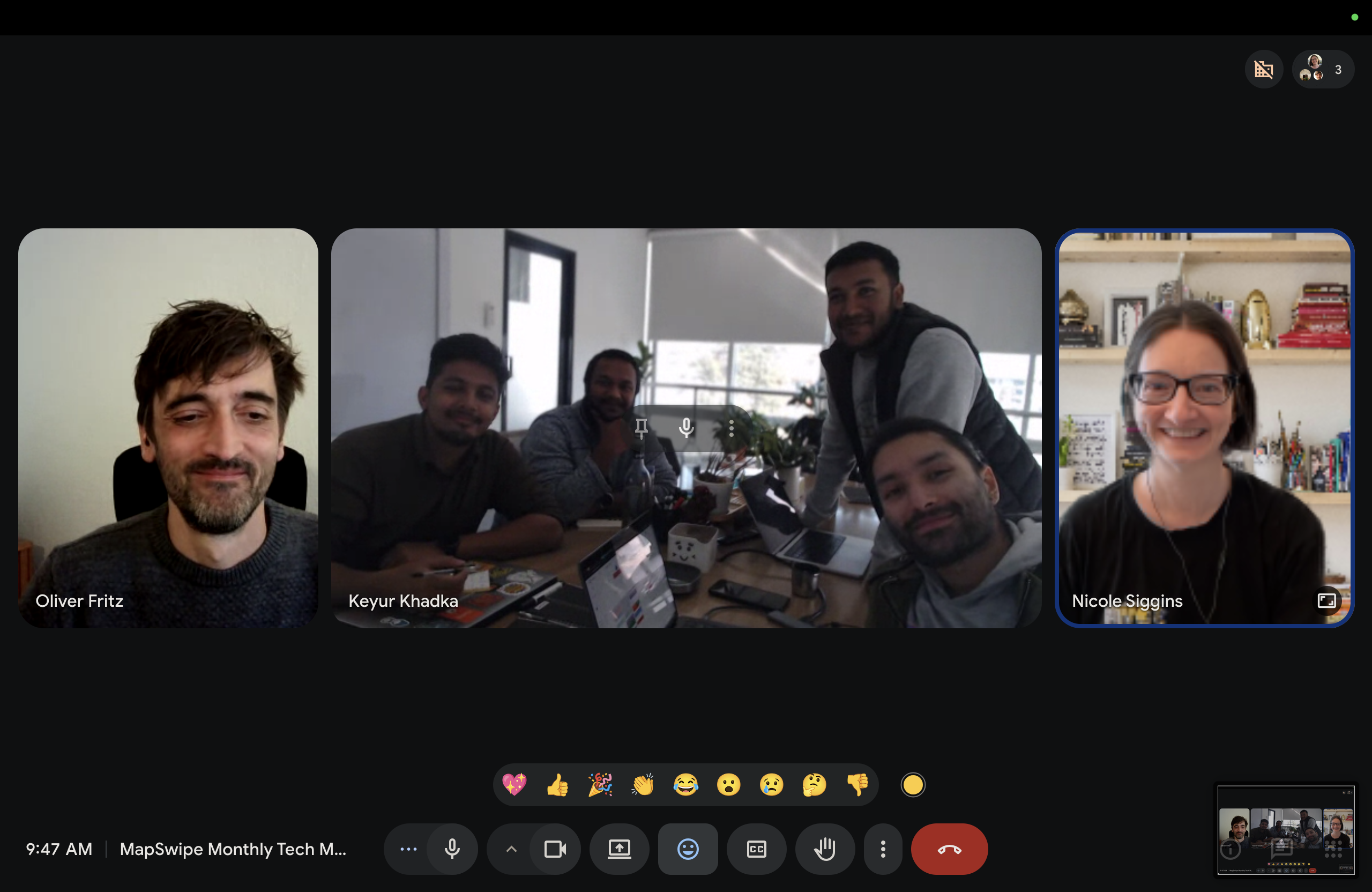
Also this year, the MapSwipe community started having a monthly tech call, which is brand new. Can you tell me a little bit about this?
Amar
Yes. The need was identified when we had a MapSwipe gathering in Belgium, by the developers, especially the technical people. We have a lot of organizations contributing to MapSwipe. For example, HeiGIT is always doing a lot of experimentation and ToggleCorp, being the technical maintainer of MapSwipe, has also been doing a lot of their own technical implementation into MapSwipe. And a lot of the time what was happening was the technical people did not have a clear way to communicate amongst each other, to share knowledge about MapSwipe and the overall developer experience.
We determined that if there was a dedicated time slot where all the technical contributors of MapSwipe would come together and discuss problems, share their findings, and share knowledge, that would be extremely helpful for the tech team and overall MapSwipe ecosystem. That's when we decided that it was time that we dedicate a separate hour every month where all the tech people who are interested can join to ask questions, give ideas, share ideas, and ask for input. It’s been working fine and it has helped a lot from a technical standpoint. It has been extremely helpful.
Nicole
It's nice that people who are into the technical side of MapSwipe have a place, a dedicated space where they know exactly what time it’s going to happen, where everything can come together. Otherwise, in volunteer projects like this, it can be really easy to not to even realize that somebody doesn't know something. That's super cool. I'm really glad that happened.
“We needed a dedicated space where technical contributors could come together and share knowledge.”
Amar
Yeah, absolutely.
Nicole
Yeah.
Amar
So, I also want to know about various project types that were created last year. For example, can you tell me a little bit about the View Streets project type?
Nicole
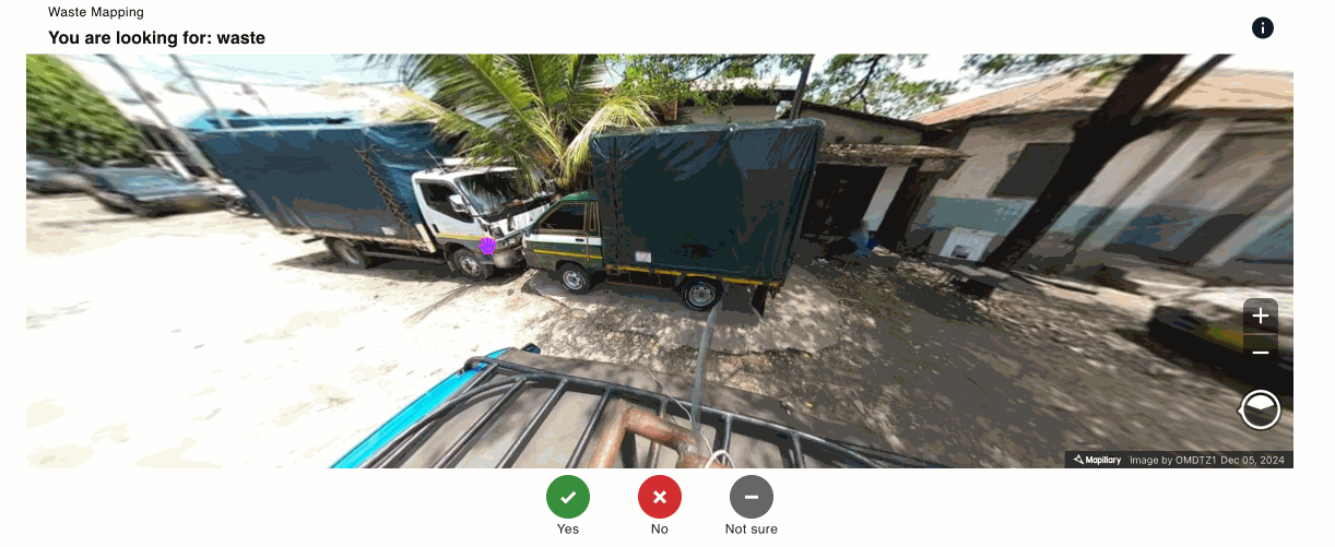
Yeah, absolutely. So this was a year for MapSwipe where quite a few different project types that had been in development in the last couple of years really started coming to fruition. One of those project types is the View Streets project type. It launched earlier this year, in March of 2025. This is a little bit of an experimental project type, you could say. It's only available on the web version of MapSwipe at the moment.
This is a project type where volunteers using MapSwipe are able to look at images from street level to then indicate some type of aspect of the features in that image. So for example, volunteers could look at images and indicate something like, is the road paved or not paved? Or is there something visible in this image? So for example, solid waste. Can you see piles of garbage? Things like that. You can also use it to indicate what type of features are in the image. So for example, is this building a hospital or a school? And it can also be used for things like, what is the surface quality of the road? So it's a really interesting project to be able to remotely view places of the world as if you were there on the street.
Amar
Do you know, is it, I know it's already in production, right? Are people using this specific project type already?
Nicole
Yeah, absolutely. It's very, very cool.
Amar
You were also involved in the Completeness project type. Can you tell me a little bit more about that?
Nicole
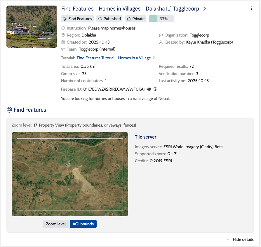
Yeah, absolutely. The Completeness project type is another project type that launched this year in the MapSwipe community, in October 2025. This is a project type where one can look for the absence of OpenStreetMap information.
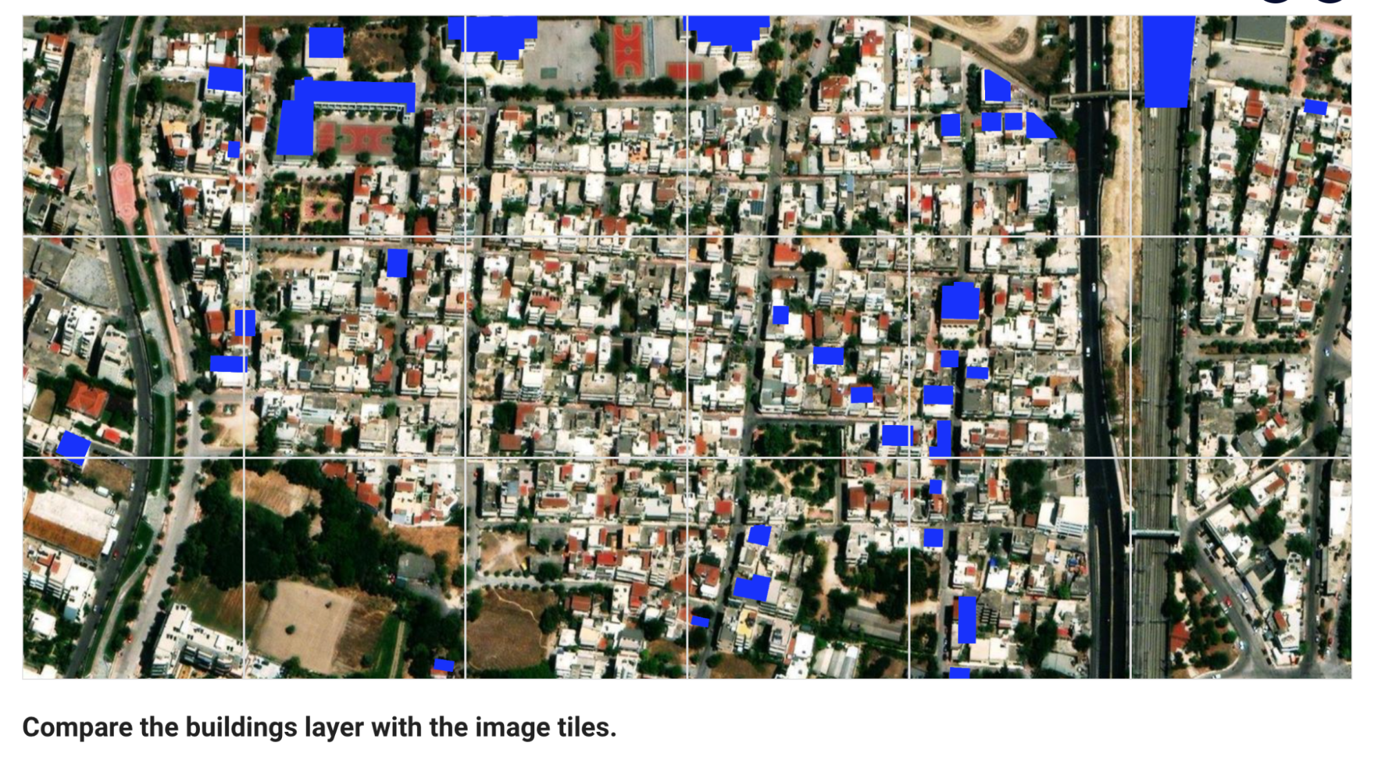
Historically with MapSwipe, a lot of the project types have been looking FOR something, right? You're asking, are there buildings in this image or are there roads in this image? But the Completeness project, it’s seeing an overlay of existing OpenStreetMap information on top of the imagery and then being able to indicate where the gaps exist. Once the project type is completed on MapSwipe, that information can then be pulled and put into something like the HOT Tasking Manager, to then get those gaps put into OpenStreetMap in an organized way. It’s really helpful because it's been historically quite difficult to find where the data isn't. It's very easy to query for something that IS, but for something that isn't has always been a bit more difficult. I’m very excited about this project type and to see where it goes in the future.
“It’s very easy to query for something that IS, but finding what isn’t has always been more difficult.”
Amar
Yeah, absolutely. Can you tell a little bit about the Assess Images project type as well? This is something that I am really interested in because I know that it has a lot of use cases. Even for someone like me in Nepal, I believe that we can also use this project type. Can you tell me a little bit more about this?
Nicole
The Assess Images project type is also a brand new project type at MapSwipe, launched about the same time as the Completeness project. This is a project where volunteers can look at a series of images and then indicate if something is actually in that image.
For example, is there a stop sign in this image? The volunteers can indicate yes, no, or unsure. The Assess Images project type also has the option for a project manager to upload an additional folder of information where they can describe what is in the image. Then the volunteers can indicate if that's true or not. I think it has a lot of interesting use cases, especially with machine learning objects and things like that. Because this project type is so new, I think we're going to begin to see over time what its use cases can be and how it can grow. I'm very excited about it. I think it opens the door to the different types of things that MapSwipe can do.
Amar
Thank you for answering all of those questions. I'll take a pause here and maybe let you ask me a question if you have any.
Nicole
I do, actually. I have an amazing question for you. This year we came to agreement within the MapSwipe community about what the maintenance for MapSwipe can look like for the next couple of years. And I'd love to hear a little bit more about it.
Amar
Yeah, absolutely. ToggleCorp, as you might know, has been the maintainer of MapSwipe for the past couple of years. And it has been going well. This year, we have increased the maintenance duration from one year to two years. It has a lot of advantages from ToggleCorp's point of view. Increasing it by one year gives us a lot more time to plan the routine maintenance of the system and the routine upgrade of some of the components of the system. It also helps us to align the roadmap according to the maintenance duration. So that's helpful. It also reduces the overhead for the management of the MapSwipe ecosystem. For example, the governance team has one less task now to do in a year. Instead of renewal every year, they can now do renewal every two years.
One of the main things is it's important for us to manage the knowledge of the system. Two years gives us an ample amount of time to document, archive all the important information, and if needed, pass the knowledge to the next maintainer. One year was too short of a time, but two years gives us enough time to do that as well. It also has a lot of other advantages, such as timely bug fixes, regular updates, enhancements, and regular communication with the community. It has been a great year from a maintenance point of view. I believe the decision to increase it from one year to two years has a significant advantage from a technical standpoint.
“A one year maintenance contract was too short. Two years gives us enough time to manage and pass on knowledge.”
Nicole
Yeah, absolutely. And it also provides some security for MapSwipe to kind of rest, grow, and think about big ideas.
Amar
Absolutely.
Nicole
Sweet.
Amar
I think we did not talk about two more project types, Nicole. I remember you mentioning the Panoramax project that you are involved in. Can you tell me a little bit more about that?
Nicole
About the future of MapSwipe! The Panoramax project type, it isn't its own project type, but it is connected to the View Streets project type. The View Streets project type, at the moment, uses imagery from a product called Mapillary. Which is a tool that people can use to upload imagery from street level. For example, you can get in your car or on your bicycle and take continuous images and then upload those. Anyone can do it. Right now, that's the one option that is available in the View Streets project.
The community really wanted to expand that and have other options. And one of those options is a project called Panoramax, which is like the open source version of Mapillary based out of France. Anyone can host their own instance. The community has been working over the last few months to figure out how that can happen. It's very, very close to being launched. It will probably be launched in the first quarter of 2026. And then we will have another open source option to look at imagery from ground level in the View Streets project.
Amar
And it's available on the MapSwipe web app, right? To start with?
Nicole
Yeah, because that's where the View Streets project is located. It's not currently in the mobile version. Good question.
Amar
That's good. And how about the Conflation project type?
Nicole
The Conflation project type is something else coming up in the future in 2026. This is a project type where volunteers will be able to analyze existing OSM building footprints with another building footprints dataset. That could be any dataset.
There's two ways this project can go. The volunteer either sees an image with one footprint overlaid over a building and indicates how well that footprint aligns with the building, or they might see an image with two different buildings and need to indicate which one fits the building better, or that none of them do. The important part is that the volunteers are not going to know which dataset is the OSM information and which is the other building footprints dataset. It's essentially a way to compare the gaps in both and create a more comprehensive database of building footprints.
This project type, which I believe will be launched in the first quarter of 2026, opens up a lot of possibilities. For example, validating machine learning building footprints. I think it's going to be really exciting, both as a project type and for the ideas it opens up. I'm very excited about that, and the future, and looking into 2026 with MapSwipe. So yeah!
Amar
Yeah!
Nicole
How exciting!
Amar
Yeah!
Nicole
Amar, I'm so glad that we got to talk today about all the cool accomplishments that the community has done with MapSwipe in the last year. And just really taking a moment to lay them out, celebrate them, and talk about moving forward into 2026.
Amar
Absolutely. Thank you so much for including me in this talk. It has been wonderful talking with you, and I really look forward to 2026.
Nicole
Yeah! See you in 2026, Amar.
Amar
Yeah! Take care.
Nicole
Bye.
Amar
Bye-bye.
Looking back on 2025, it’s clear that MapSwipe didn’t just add new features, it also strengthened its foundations. From improving the day-to-day experience of project managers and developers to opening up new ways of validating and improving OpenStreetMap data, the work described in this conversation reflects a growing, collaborative, and forward-thinking community.
As MapSwipe moves into 2026, these changes create space for bigger ideas, deeper collaboration, and for new contributors to get involved. A huge thank you to everyone - developers, project managers, volunteers, and community members - who helped make this year possible.
Here’s to what comes next!
