
Swiping to Search for Returnees in Syria
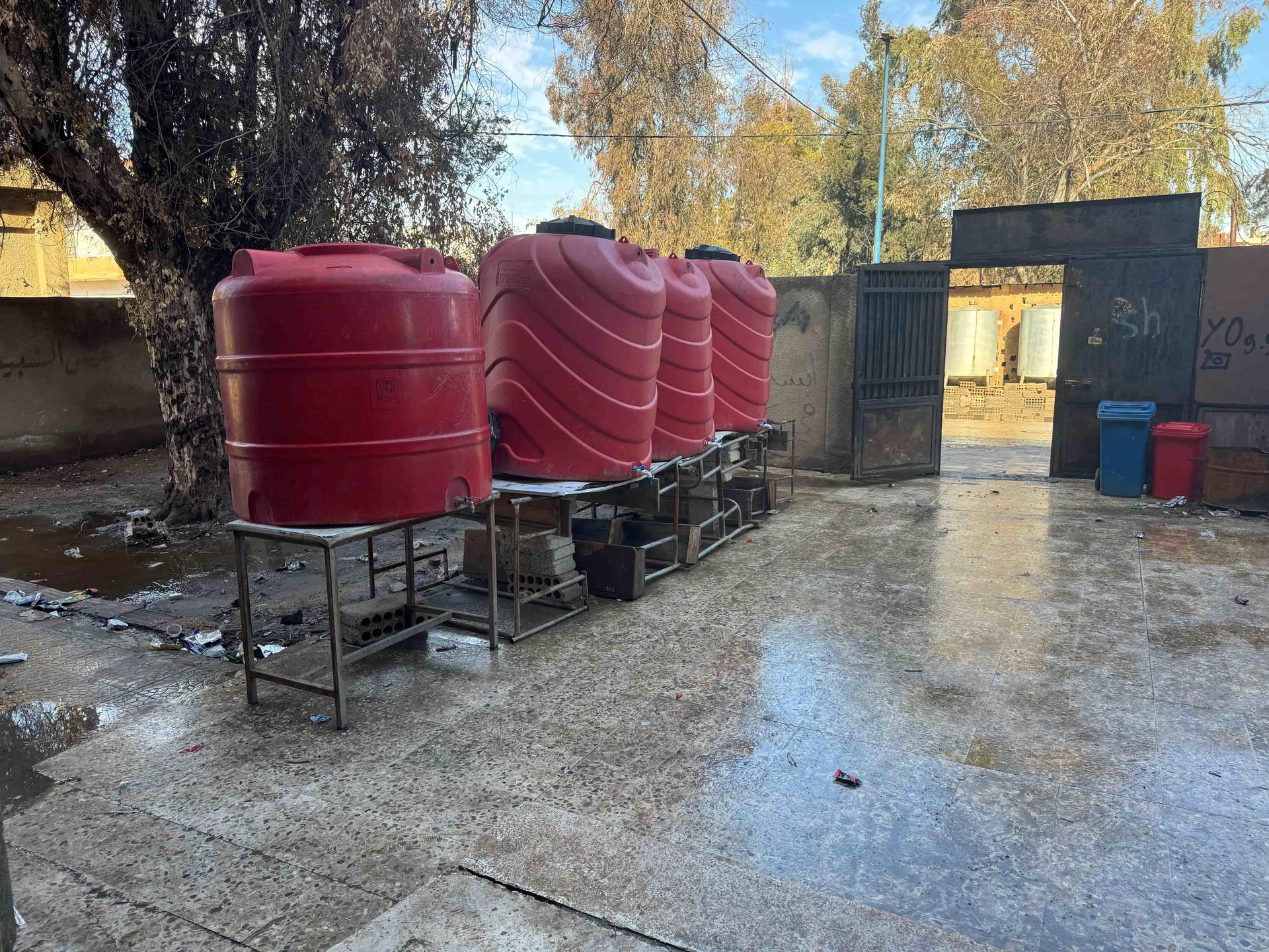
In 2025, Médecins Sans Frontières / Doctors Without Borders (MSF) teams were expanding support to meet people’s health needs across Syria. Internally displaced Syrians were moving back to their areas of origin and often returning to areas of housing and infrastructure damaged by the years of war. A question arose from the water and sanitation specialists who were looking into carrying out an assessment of boreholes for water provision: Is it possible to understand the population distribution in damaged neighbourhoods? It was, since people need water and energy in all kinds of conditions.
After 13 years of civil conflict, Syria is now slowly starting to recover and rebuild. In the areas where MSF is working in Deir ez-Zor governorate, estimates indicate that 50% of houses and buildings were damaged or completely destroyed. Many people fled the fighting and left this area. “Now that the situation has somewhat stabilized, we are seeing many people returning to these damaged areas and moving back into buildings that were previously their homes and slowly starting to rehabilitate. Current population estimates for these areas are extremely difficult to obtain, which also makes it difficult to make operational decisions about the most impactful areas to intervene in. This Missing Maps project is aiming to help us get a better picture of the returning population, which areas are most heavily populated and how quickly neighborhoods are being repopulated, to help us better target our health and water-related support to these returning populations.”
Using satellite imagery, the MSF Earth Observation team conducted automatic remote damage assessments. However, the method had a significant limitation. They could not detect internal damage to the walls and windows of a building when the roof looked intact. On the ground, MSF teams found that people were living in, or right next to, buildings open to the elements so only doing an automatic remote damage assessment of buildings was not going to provide a reasonable estimate of population distribution in this case.
Another option was to manually go through the satellite imagery of the area of interest and identify specific features that could indicate population distribution. We needed to choose a feature visible in satellite imagery that could act as a proxy to help indicate buildings that, despite visible damage, may still be inhabited. A few options were discussed such as detecting lights at night, searching for the presence of cars, or using thermal images that capture the heat emitted from daily activities. Ultimately, after consulting with the local teams, the presence of solar panels or water tanks on a roof of a building were decided as the features we should look for on satellite images.
The next question was: “Can MapSwipe volunteers find them?”
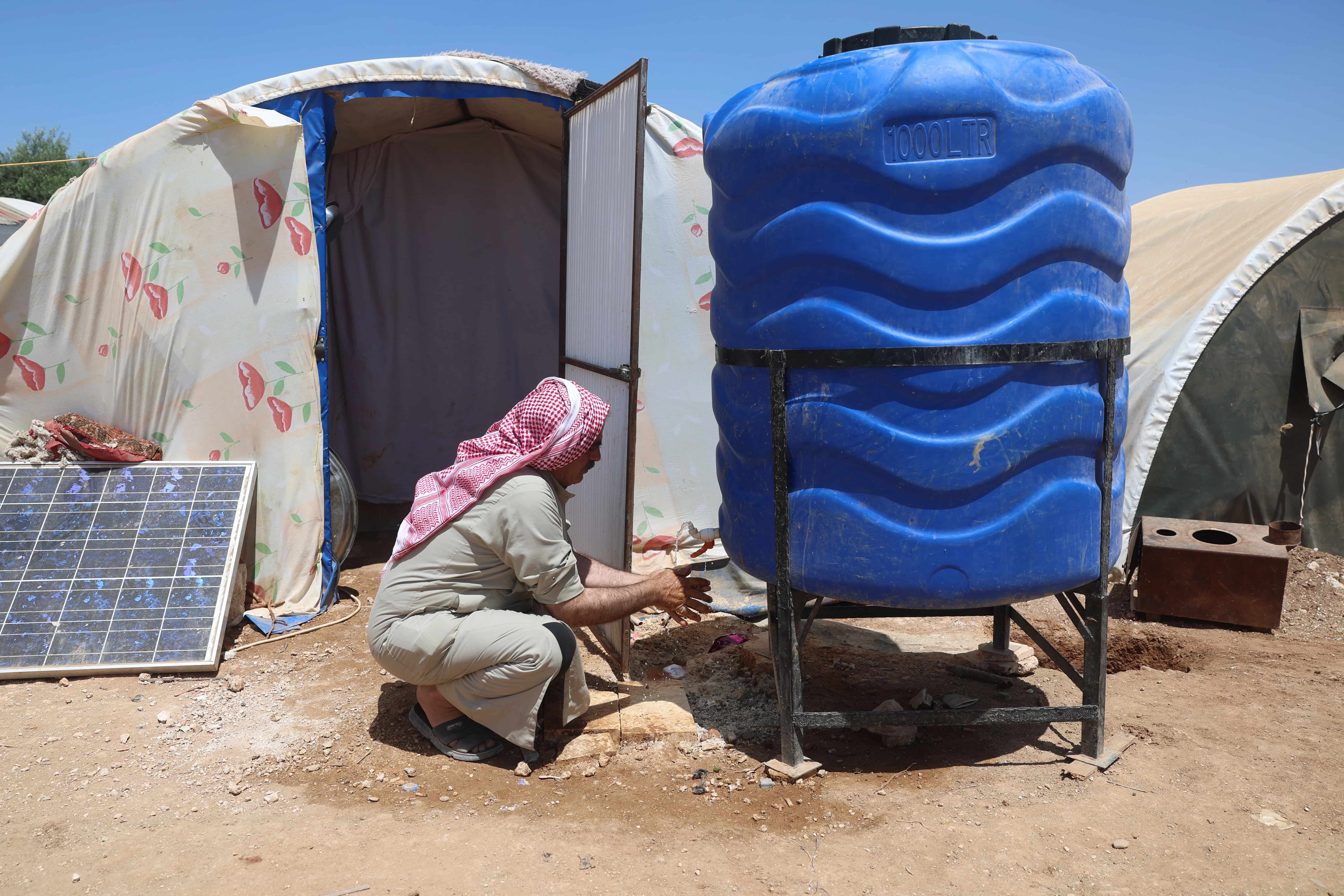
A displaced Syrian using a water tank and a solar panel /MSF
Setting up the project
A typical MapSwipe project feature to find is a building. Water tanks and solar panels are significantly smaller and so a lot of thought had to be put into setting up the project.
Since it was important to pay attention to the size and shapes of those objects, creating a tailored tutorial was of high importance. We needed to provide several examples of what volunteers might encounter, as well as tips and tricks for identifying these new features.
We asked volunteers to go through high resolution (30 cm) satellite imagery and instructed them to mark areas as ‘yes,’ if they could see either a water tank or a solar panel in it. Volunteers could also mark an area as ‘uncertain,’ if they were not sure. As in any other MapSwipe project, all areas would be seen by more than one volunteer, and the output data would be an aggregation of these votes.
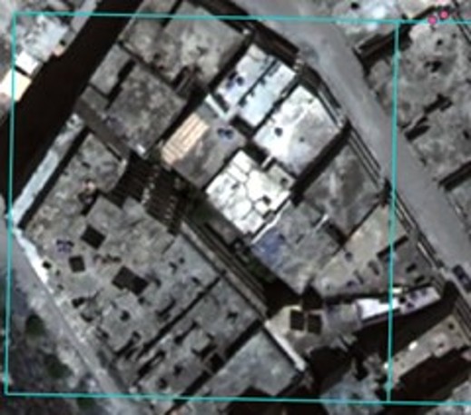
A task square that contains solar panels and water tanks / Airbus DS (2024), provided by the Airbus Foundation
We invited a group of experienced volunteer mappers to do this project as they all had participated on several MapSwipe projects before and seen multiple types of satellite imagery. Over a two-hour period, the volunteers managed to look at the imagery for the whole project area. They did a great job in spotting the red water tanks and solar panels among the shadows on the roofs of the buildings!
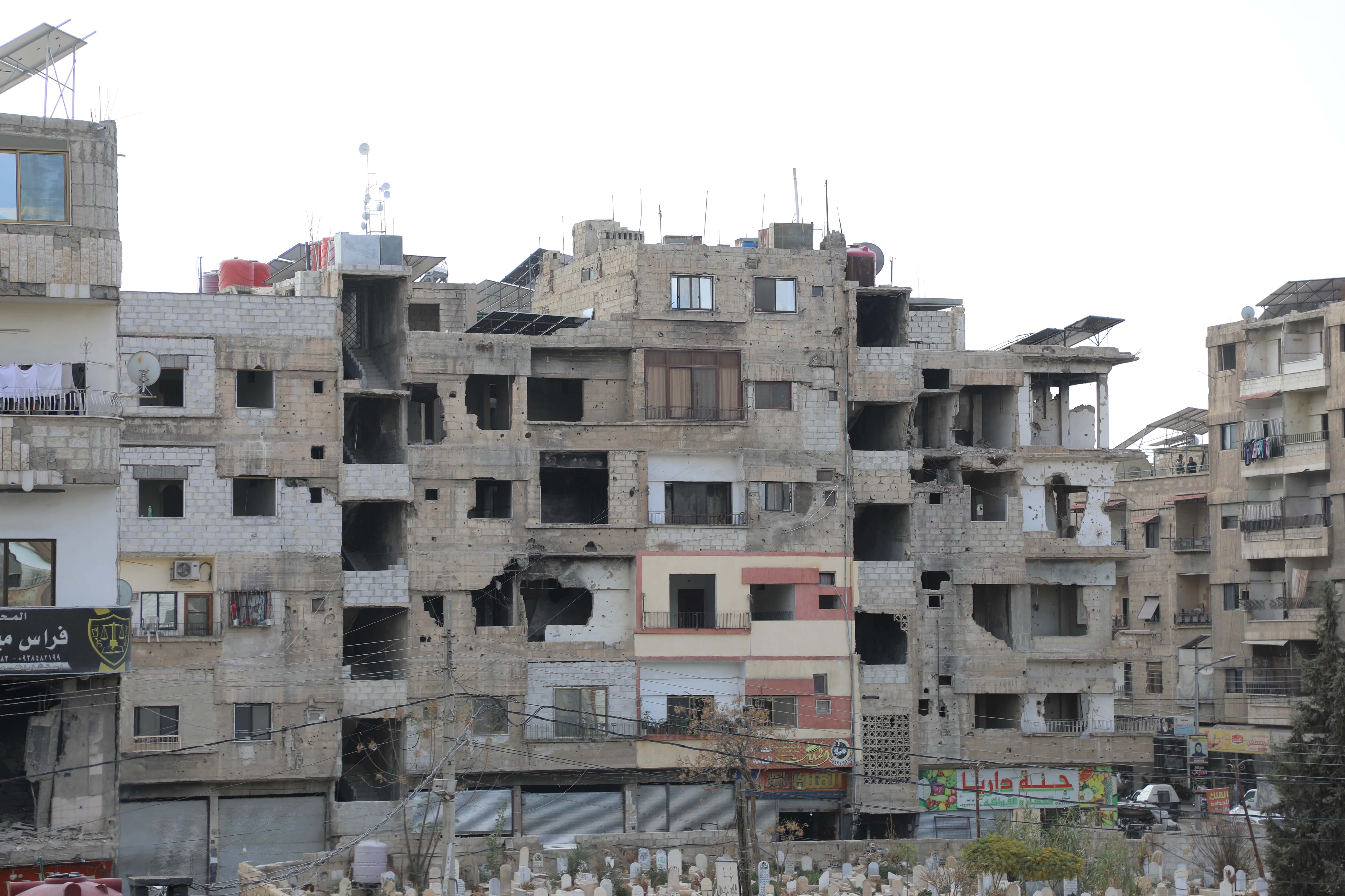
You can see the red water tanks and solar panels on the roofs of partially constructed buildings /MSF
Signs of Life
In parallel to this MapSwipe project, a similar project was done by analysts of the MSF Earth Observation team where they manually marked the locations of solar panels and water tanks on the same satellite imagery.
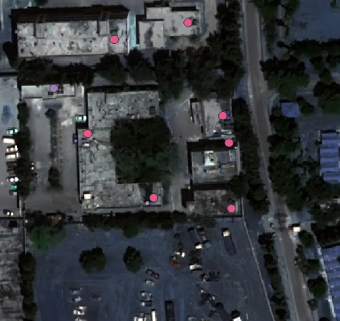
Points showing building locations of solar panels (purple) or water tanks (pink). / Airbus DS (2024), provided by the Airbus Foundation
In comparing the two result data sets with each other, we concluded that the accuracy of the MapSwipe volunteers was very high and the results were comparable to the analysts’ work. Using the power of crowdsourcing with MapSwipe also meant that this project was done much faster than when MSF staff did it, which was another exciting result. Both the accuracy of the swiping and the speed of the project completion mean that this innovative new use of MapSwipe is a viable option to meet MSF’s mapping needs in similar contexts in the future.
With this success under our belts, we have already done another MapSwipe project to map out the distribution of a population in a war-damaged neighbourhoods by searching for signs of life, these red water tanks and solar panels.
Thank you to the volunteers who were willing to trial a new project with us and gave their time and feedback. Thank you to the MSF Earth Observation team who shared their results with us and supported the comparative analysis. Thank you to the MSF team in Syria who initially asked us a question that led us to this experiment. If you are interested in how you could use MapSwipe for your organization or a similar project, do not hesitate to contact the MapSwipe team on info@mapswipe.org.
